

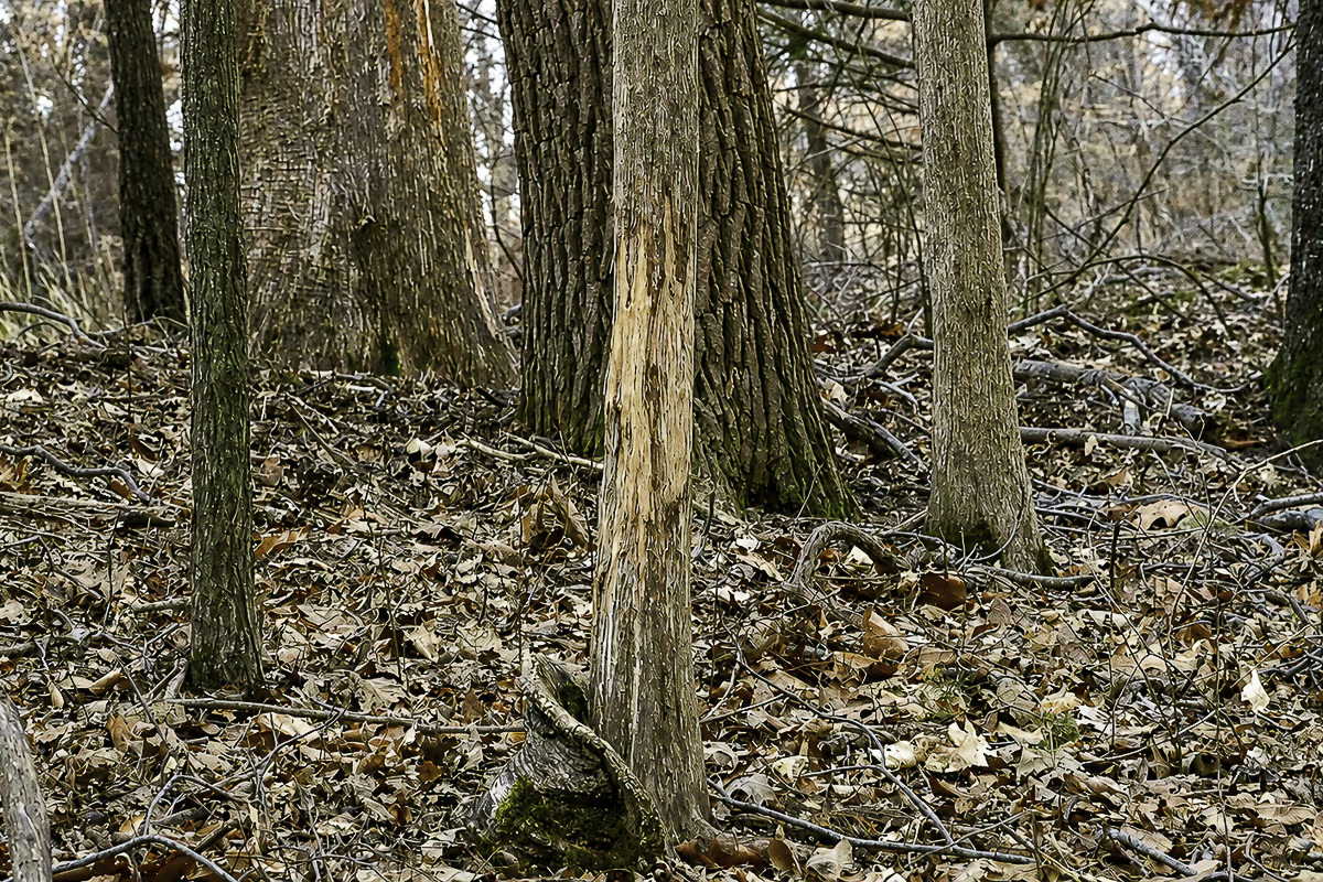
About three quarters of a mile from the road, walking the bottom of a bluff the topo map swore ran unbroken through the entire property, I found it. A ravine the map didn’t show. The climb was steep enough that somewhere around halfway up I started making promises to myself about getting back in the gym. Scattered through the timber on top were some of the biggest rubs I’ve found on public land.
I didn’t find that spot by just scouting deer. but also considering what other hunters were doing. Don’t just look for deer sign on public land. Sometimes you have to find the hunter sign before you find the mature buck sign.
Why Scouting Deer First Is Backwards on Public Land
Every piece of scouting advice you’ll read starts the same way. Find the food. Find the bedding. Walk the edges. Mark the sign. And on private ground, that’s exactly right. I follow the same playbook myself, and have written about it in other articles.
Here’s where you run into problems on public land. When you simplify it, what your looking for on the map looks almost identical on every property. Food, cover, water, edges, they’re all there, and every hunter with a mapping app has already marked the same spots you’re about to mark. What’s different on public ground isn’t the deer. It’s the people. And the people are the variable that decides where a mature buck spends his time in daylight.
I’m not saying that deer sign doesn’t matter when scouting whitetail deer public land because it does. For me, it just comes second. Yes, deer sign does tell you where a deer was. What it doesn’t tell you is whether they were there during daylight hours during the season. In my experience scouting public ground the answer to that question lies with other hunters.
Map the Hunters Before the Deer
When I pull up a new piece of public ground on the map, I don’t start with food or bedding. I start with every spot a truck can conveniently park.
Mark the convenient access first.
Pull-offs at the head of a trail. Fire breaks. Gates. Parking lots. Anywhere a hunter can get off the road and into the property without much thought. These are the front doors, and the majority of hunters will use them.
Predict the routes in.
From each access point, follow the path of least resistance. Trails, logging roads, open timber, ridgelines with easy walking. Hunters flow into a property the same way water flows downhill, and after you’ve done this a few times you can guess their routes with surprising accuracy.
Draw the pressure zones.
Around each access point and along each easy route, picture a bubble of pressure. Everything inside those bubbles is where the deer will likely be hunted. Everything outside them is where the mature bucks will likely be living.
For simplicity sake we’ll call this the pressure map and honestly you can put most of this together from your kitchen table. The gaps in these “pressure bubbles”, the ground that not convenient to get to from the access point, are the spots worth your boot leather. In my experience, that’s where I find nearly all the mature buck sign. Bucks don’t get to the mature status by not knowing where the bulk of the hunters like to hang out.
The Ravine That Wasn’t on the Map
Back to that ravine, because the spot almost didn’t happen, and the reason it almost didn’t happen is the lesson.
The parking and access on that piece ran along the bottom of a bluff. One side of the trail was huntable ground and that’s where all hunter sign showed up. The other side was the bluff, and nobody wanted anything to do with it. You couldn’t get to top from the far side because it bordered private land. So that entire section sat there, public, legal, and from what I could tell, untouched.
I’d studied the topo maps, and based on the maps I’d written it off too. The contour lines showed straight bluff the whole way. No breaks and seemingly no way up. The map and I agreed with every other hunter on the property, and that should have been my first clue.
On one scouting trip I decided to walk the bottom of it anyway, mostly out of curiosity. Three quarters of a mile from the road I found a ditch cutting up through the bluff that no map I’d ever seen showed. It made the top reachable. Not easy, but possible, which on public land is the best word there is.
On the way up I started noticing tracks. The deer had figured out the same thing I had and were using it as a highway between the bottom and the top. When I finally topped out, the first thing I noticed was the string of big rubs through the timber, the kind of sign the pressured side of the trail hadn’t shown me anywhere.
Here’s the part I want you to take from that. The topo map didn’t lie on purpose. Contour lines smooth over anything smaller than their interval, and a ravine you can climb through can hide between them. If I’d trusted the map, I’d have never known that ground existed as huntable country. The pressure map told me where to look. My boots found the door.
Read the Hunters on the Ground Too
Once you’re walking a piece of public property, you’re scouting two animals, and the human one leaves plenty of sign of its own. I pay as much attention to it as I do deer sign.
Old stands, screw-in steps, or the side of a tree beat up from years of climber abuse tell you a spot has history and will probably be occupied again. Reflective tacks mark somebody’s entrance and exit route in the dark, and following one backward shows you exactly which access point feeds it. Boot tracks on a muddy trail tell you how recently and how far in people are moving. Cut shooting lanes, dropped candy wrappers, somebody’s trail camera, all of it gets pinned in OnX.
One more thing the pressure map catches that only scouting for deer sign misses. The overlooked ground isn’t always deep. Some of it sits in the thick stuff 80 yards from the road, cover so nasty that everybody walks past it on their way to the “real” spots.
A lifelong friend of mine who hunts public ground here in Kentucky hunts the thickest cover he can find right next to the road, and he deals with a fraction of the hunters everyone else does. Near or far doesn’t matter. Inside or outside the pressure zones is what matters.
Turning the Pressure Map Into a Hunt Plan
Once the pressured areas and deer sign are pinned on the map, how to hunt the property mostly writes itself but here’s a few things to keep in mind.
Equal amounts of deer sign don’t mean equal opportunity.
Two spots with equal deer sign are not always equal. The one on the opposite side of a creek crossing, a bluff, or a half mile of blowdowns will produce better hunts consistently than the one a quarter mile up a walking trail.
Plan your own access like a hunter is scouting you.
Because one or more hunters probably are. If you’re leaving boot tracks down the main trail or tacks on every tree, you’ve just handed your spot to the first hunter that comes across it.
Expect to eat some miles for nothing.
I won’t lie to you. Hunting the gaps in the pressure means walking ground other hunters skipped, and sometimes it’s for not. That bluff top paid off but plenty of my curiosity walks haven’t. This method of scouting public land stacks the odds, but it doesn’t guarantee a successful outcome.
Recheck the map every season.
Pressure changes from season to season. A new gate, a washed-out road, or a logging operation redraws the whole thing. The properties I do best on are the ones where I’ve watched the parking areas long enough to know which ones fill up and when.
Wrapping Up
Scouting for deer on public land isn’t a different skill from scouting anywhere else. It’s the same skill with an added step. Map the access, predict the people, and hunt the ground the “pressure map” leaves behind, because that’s the ground where a mature buck can get old.
On public ground, mature buck sign doesn’t just show you where the deer live. It shows you where the hunters likely aren’t.